 |
Mt. Washington Temp.
Click pic for forecast.
| ...More Topics... |
 Books Books |
| Bulletin Board |
| Clubs & Huts - AMC Huts |
| Feedback |
| 4,000 footers |
| Hiking Glossary |
| Mail List |
| Privacy Policy |
| Store |
| Weather |
| Search |
|
|


![]()
![]()


The hike that would never end – two more 4,000 footers in one (long) day.
Whitehouse Trail to Liberty Spring Trail to Flume Slide Trail to Osseo Trail to Franconia Ridge Trail to Liberty Spring Trail (again)
Click HERE for a summary of this hike with maps!

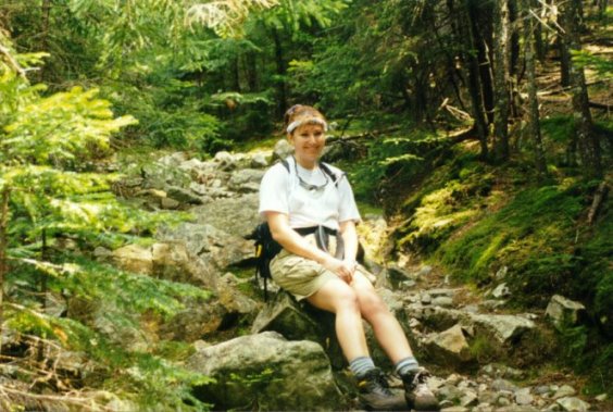
The thermometer reached 95° F in sunny NH so Rob, Pamela and Chris thought, "what better way to suffer through the heat and ridiculous humidity than to take a long hike up a steep mountain?" Well, that’s just what we did.
The drive up to the Flume visitors’ center was uneventful and easy. Just a smooth ride up to exit 33 off I-93, then a mile up the road and we were in the hikers’ parking area ready to jump on the Liberty Brook Trail via the Cascade Trail. From the parking lot, we hiked a flat .6 miles to the paved bike path on the Whitehouse Trail. Once on the bike path, it was a quick .2 mile to a pedestrian bridge and the Liberty Spring Trail junction. The heat was a little less daunting than at the Seacoast, but we brought a combined 12 quarts of water and a PUR Scout filter just in case. 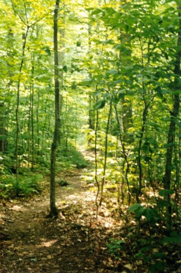 The trail started out easy with a slight grade and good footing, although the trail is not smooth. Granite everywhere makes this an orthopedic surgeon’s nightmare if you’re not careful. At about 1 mile, we met the junction of the Flume Slide Trail and peeled off to the right to follow it.
At about 1.6 miles we came to the first of several easy stream crossings. At this point we were already drenched thanks to the high heat and humidity, so we stopped to enjoy the cool spring water for a few minutes. After some cooling down we continued up the Flume Slide Trail. The incline increased (with our heart rates) and before long we were gasping for air and water. 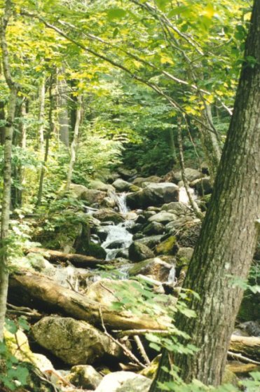 Although we were denied views, we did come to the second steam crossing at about 2 miles. At this point, we realized that we were consuming WAY too much water so we paused to filter some into our Platypuses (Platypi?) and had a little snack. Now I know what you’re thinking – wimps – but in 90°
heat with all that humidity, this became a vigorous hike! Really!
Although we were denied views, we did come to the second steam crossing at about 2 miles. At this point, we realized that we were consuming WAY too much water so we paused to filter some into our Platypuses (Platypi?) and had a little snack. Now I know what you’re thinking – wimps – but in 90°
heat with all that humidity, this became a vigorous hike! Really!
We continued onward and upward for a while and the trail continued to get steeper and rockier. This was all in preparation for a walk up the Flume Slide, which isn’t really -- uhh -- fun. Throughout most of the hike so far the views were restricted, and except at the few stream crossings, there wasn’t much to look at. By this point, the heat was beginning to take its toll on us and we were moving considerably slower than normal. As the trail continued, the climbing got steeper and the rocks got bigger. After crossing a couple more small brooks, the trail turned away from the brook and started becoming more gravelly as we approached the Flume Slide.
The White Mountain Guide has this to say about the Flume Slide: "It is an extremely steep, rough trail, with polished rock slabs that are extremely slippery when wet (and they are nearly always wet, due to the many seep springs on these steep slopes). It is not recommended for descent and its use is discouraged in wet weather when the ledges are more than ordinarily dangerous." We were lucky (?) to be hiking the trail during a moderate drought in New Hampshire, so the slabs were actually dry for us. But even under ideal conditions, this was not an easy hike. There is real climbing involved, and if heights scare you or you are not comfortable hiking on slickrock, you might want to investigate an alternate route (like following the Liberty Spring Trail the entire way).
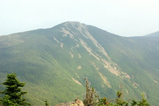
The slide was an interesting and difficult climb under these conditions. We would say it was a slightly less difficult climb than the North Slide of Tripyramid. However, the overall hike, including the long, steep approach was far more grueling (and the 90-degree heat didn’t help). However, although the slide is mostly overgrown, it does open up near the top and offered us the first real views of the trip. These views had the potential to be spectacular if the haze weren’t bad enough to cut the view down to a mile and ˝.
Throughout this hike, every time we felt like we were getting close to the top we’d turn another corner and see another mile of trail ahead of us. By the time we reached the top of Mt. Flume we were definitely ready for a break. Between the heat, the humidity, and the grueling climb we were beat and ready for food. So we relaxed, ate, and rested for a good 30 minutes. The views from the top of Flume were decent, and although there were people around, they left after about 10 minutes and we had the peak to ourselves. After cooling off in the light breeze we moved out towards Mt. Liberty.
The hike through the saddle was uneventful, and a good rest for our legs. In this portion of the trail we came across the first real opportunities for camping that we had seen. This makes sense considering the proximity to the Appalachian Trail (The AT is the Liberty Spring Trail in this region). The camping opportunities weren’t abundant, mind you, but there were a few. 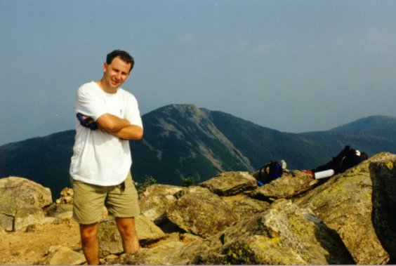 Once again, as we proceeded through the saddle and began the climb to the summit of Liberty, our legs started to give out again. And once again, this seemed like the never-ending climb. Each time we thought we should be getting near the top, we’d get a glimpse of the real summit and see that we were way far away. By the time we really were close it was getting kind of discouraging.
The summit of Mt. Liberty provided us with some more decent views, although the haze was still pretty bad. As we sat and rested and drank more water, we realized that the hour was advancing and we still had a decent hike back to the car. So, after about 20 minutes, we pushed ourselves to go on and started down the trail. After a few minutes we came across the Liberty Spring Campsite on the AT. The Liberty Spring Campsite is conveniently located at, you guessed it, the Liberty Spring.  When we walked past, the spring was surrounded by hot, tired backpackers all filling up their water bottles before settling down for the evening. Even on this hot a day the campsite had maybe 10 backpackers staying there. The Liberty Spring Campsite is decent as AT campsites go. There is a caretaker (with a huge canvas wall tent and a bed), a number of tent platforms, the spring for water, and other facilities. We didn’t inquire as to how much of a fee was charged.
At the Campsite, we neglected to fill up our water again figuring that we would pass a few more streams along the way. Wrong. We didn’t hit water again until nearly the end of the trail (at one of the brooks we passed coming in) and by that time we were nearly dry again. The hike down was long and steady, and by the time we got to the end we were beyond beat. We reached the parking lot at about eight o’clock at night. Still daylight left, but later than we had wanted.

If the weather were wet, we would definitely suggest the Liberty Spring Trail as the way to go. And, if you are carrying a big pack this might also be the better choice. Although the climb is the same either way, the Liberty Spring Trail is steadier over its entire length, rather than flat at the beginning and then really steep. However, both of these trails can be best described as, "long, man. Just long and up. A lot." Perhaps this hike would have been easier if it weren’t 90 degrees out with humidity you could cut. Overall, though, we’d say that it’s a tough one no matter what the weather is.

Chris Oberg & Robert Havasy
Hike-NH.com