 |
| ...More Topics... |
 Books Books |
 Bulletin Board Bulletin Board |
 Clubs & Huts Clubs & Huts- AMC Huts |
 Feedback Feedback |
 4,000 footers 4,000 footers |
 Hiking Glossary Hiking Glossary |
 Mail List Mail List |
 Privacy Policy Privacy Policy |
 Store Store |
 Weather Weather |
| Search |
|
|


Mt. Madison Hike Page 2
As we finally got to the top of the third Howk, we reached a point where the trees were no longer sheltering us from the wind and we began to feel it's full effects. And man was it strong. We hunkered down behind some rocks and discussed our options. We knew that after breaking out of the trees totally we had over a mile of exposed ridge to walk. These were the factors in our decision:
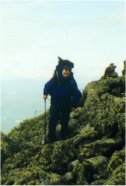
- The weather did not appear to be getting worse. The clouds in the distance looked like they were thinning.
- When we reached treeline we would have about 6 hours of full daylight left to cover 1.5 miles.
- It was not raining any more.
- We were warm. (Remember that remarkable warm-front which had passed through the night before?)
- The hike back down to our camp would be longer and over worse steep wet terrain than continuing to the Madison Springs hut where we had reservations and a warm dry bed waiting.
In the end, we realized that the biggest problem was going to be the wind. It was not cold and we were not wet, so hypothermia was not something we were immediately worried about. We both had plenty of warm dry clothes that we could put on if needed, as well as survival gear (sleeping bags, emergency space-blankets, food, and water) to survive the night most anywhere. Although worried about comfort we were not worried about survival. So we made what we feel was the best possible decision. We changed our route and agreed to turn onto the Pine Link Trail which runs about 300 feet below the summit of Madison instead of climbing to the ridge. This was beneficial for three reasons:
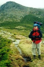
1. Although still exposed to the wind, the Pine Link Trail ran on the side of the mountain so we would be better able to brace ourselves against the wind.
2. It was a shorter, more direct route to the Madison Spring Hut, with about 400' less climbing and .4 miles less distance to walk.
3. About ½ way across the open traverse, the Watson Path provided a difficult but possible escape-route straight down the ravine into the trees if conditions became unbearable.
So we pushed on and turned onto the Pine Link Trail. The walk across the side of Madison was difficult to say the least. The trail is a scramble over boulders and rock and the wind was blowing harder than either of us can ever remember. With large packs on our backs, it was all we could do to remain upright. There were times when we had to lean 45 degrees into the wind just to stay in one place. The trail became a fight to stumble from cairn to cairn where you could hunker down and get a few seconds of rest. The whole time, the cloud ceiling stayed in place just above us so visibility wasn't really a problem at our level. We fought our way through the wind and reached the junction of the Watson Path - our escape route. We decided that we could still make the hut, knowing that the trail would begin turning to the south and the wind would get lighter as we approached the ravine. After an hour or so of walking, we finally turned the corner and saw the roof of the Madison Spring Hut.
We stumbled into the hut wet and tired and crumbled into a heap for 30 minutes at about 3:30 that afternoon. Then an amazing thing happened. By evening, the sky had cleared and the winds had died considerably. Go figure.
Actual conditions on the higher summits 6/09: Mostly in the clouds. High temp: 55 degrees. Peak wind gust: 88 m.p.h.
Day 3, Saturday, 6/10/2000
Weather forecast (Higher Summits):
Temps in the 50s. In and out of the clouds. Lows in the 40s. Winds moderate to high. Possible cold-front moving though by afternoon.
The hut Croo awoke us at 6:30 which wasn't really necessary given the fact that Chris and I were both awake because of the snoring and other obnoxious noises that had been keeping us awake all night. Combined, we didn't sleep total of 3 hours. This among other factors would bring us to the breaking point of this trip.
After breakfast, at about 7:30 or so, the hut was socked in the clouds and fog with visibility less than 50 feet (at times much less). And the winds were back and howling. We looked at our options and our conditions and took stock of our situation. Here's what we discovered:
- In the previous 48 hours, due to winds and snoring we had each gotten about 4 or 5 hours of sleep total. This means we were tired. Tired people make bad decisions sometimes.
- Outside the hut we were in the fog. That meant all of the peaks were in the fog. We could see maybe 50 feet at the hut, we assumed (correctly) that the visibility on the peaks would be worse.
- The fog was condensing and soaking everything it touched.
- Our legs were beat after the previous two days of climbing and fighting the wind.
- The wind was still blowing hard.
In short, there was no way we were going to make 6+ miles in those conditions and carry packs over three 5000+ foot summits. We were tired. The weather beat us. We amended the plan once again. We would grab minimal gear and make a quick dash to the summit of Mt. Madison only .5 miles from the hut, then return, load up, and head straight down the air-line trail to the parking area and out to a dinner at the Yankee Smokehouse.
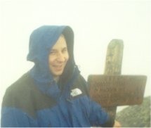
We grabbed some warm clothes, our raingear, and some water and hit the trail to the Madison summit at about 8:00. The entire way was exposed to the wind which was blowing at about 40-50 m.p.h. Visibility was really bad. We could see between 25 and 50 feet depending on the moment. Luckily, the trail from the hut to the summit was well marked and the cairns were close enough together that we could see from one to the other. However, we could hardly ever see more than one ahead. Although not as strong as the day before, the wind made the going rough. The final 50 yards of the climb was done as a crawl on hands and knees. But, we made it. Another 4000 footer bagged. The .5 miles back to the hut went quickly. Through it all, the fog seemed to soak everything it touched. But, the temperature was still remarkably warm, the one bit of luck we had throughout the trip. Many of the decisions we made would have been changed substantially if it had been cold out and hypothermia was more of a concern.
Back at the hut, we grabbed the rest of our gear and started a long tiring decent down the Air Line Trail. The first mile or so is pretty exposed and the decent is pretty steep. On a clear day, the views should be great, but we can't really say one way or the other. All we saw was fog. About 1/3 of the way down, we had descended into the trees and were once again sheltered from the wind. At this point we ran into a gentleman who suggested that we divert from the Air Line trail onto the Scar Trail to avoid some particularly difficult rocky sections. Whether this was good advice or not we can't tell you because we don't know what we missed on the Air Line Trail, but we can say that the Scar Trail is no picnic. In this case, it was mostly because we traded steep rocky scrambles for moderately steep tree-root covered slopes. We can also tell you two more things:
1. Wet tree roots are really slippery.
2. It was really wet.
Enough said. Footing was difficult. The Scar Trail trades some of the steepness of the Air Line for a little extra distance - it connects the Air Line Trail to the Valley Way Trail and added probably .5 miles to the hike out. For future reference, the Scar Trail is very mossy, boggy, and wet. Keep this in mind. Once again, the trail doesn't appear to offer great views, but even after we had gotten out of the fog it was still overcast and cloudy and we couldn't see anything even if it did.

So we plodded along, wet and tired, and just kept heading for the parking area. Along the way we passed a trail crew on the Valley Way trail fixing some of the drainage and doing some maintenance, as well as one or two other hikers.
Actual conditions on the higher summits 6/10: Mostly in the clouds. High temp: 55 degrees. Peak wind gust: 87 m.p.h.
I think we can both say that this was one of the more difficult hikes we have ever done, due mainly to the overwhelmingly bad conditions. As usual, there wasn't one thing that made or broke the trip. And taken separately out of context, none of the conditions we were in were either unusual for the area or remarkably dangerous. But the combined, synergistic effect slowly wore us down into a quivering mass of Jell-O. Even with 25 years of combined hiking experience in all kinds of weather and all parts of the country, I think we would admit that for some period on Friday, during the worst of the wind, we were a little scared. We were in conditions that had two of the three things that make most of the disaster stories in the White Mountains possible. Wind and wet. The only thing we were missing was cold. Had the temperature been even 10 degrees colder, or had we not had good, solid, raingear and warm synthetic clothes, then our choices would have been profoundly different.
You will hear of many people who have walked through worse conditions with less/worse gear. Heck, we met many of them at the Madison Spring Hut Friday evening. The amazing thing is that people arriving at the same destination, on the same day experienced profoundly different conditions.
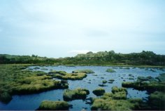 Those people that arrived at the hut, who had begun at the parking area on Friday morning didn't experience the 2 hours of rain that we did, and didn't battle the winds for as long as we did, all after a relatively sleepless night. The point is that you can not always rely on other people's experiences for guidance in your own situations. Two groups of people on Mt. Madison Friday, separated only by 2 or 3 miles, will give you two entirely different ideas of what it was like up there. Should we have turned around given the conditions we were in? In hindsight, we know we made an acceptable choice. Would we make the same choices again? Maybe. Would this be the correct choice for you if you were in the same situation? We can't say. We only hope that as responsible hikers you will stop and think about these things. Objectively evaluating the situation you are in, including both the environmental and your own physical conditions is the essence of hiking responsibly. The willingness to adjust your plans based on the conditions in which you find yourself is what it's all about. The mountains will always be there for you to try again on another day when the weather is better. After all, we do this for the fun, right? There's no shame in turning around when the fun starts to fade.
Chris Oberg & Robert Havasy
Hike-NH.com
